-
Share this page
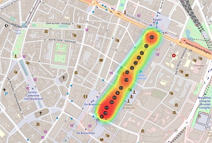
Crowd monitoring
Problem statement
Event organizers have expressed their interest in developing novel technologies supporting crowd control to:
- monitor events in real time
- predict crowd counts in the future
- perform post-analyses
In particular, computing real-time crowd densities in strategic areas allows security managers to decide whether an event has reached its maximum capacity. Crowd count time series can be fed into forecasting algorithms to predict overcrowding—which allows security personnel to execute countermeasures anticipatedly and enhances therefore the security of large public events.
Contributions
The developed crowd monitoring system relies on Wi-Fi sensors installed throughout the event. These sensors passively detect the beacon signals transmitted by cell phones with Wi-Fi switched on. These are transmitted even if a phone is not connected to a Wi-Fi network and do not contain any personal information. These beacons, pre-processed on the sensors and anonymized, are sent over an encrypted channel to a central server, typically via a 4G network.
By measuring the rate at which beacon signals are sent out over an area, it is possible to deduce the number of individuals owning a device with Wi-Fi enabled; from this, an extrapolation can be made to estimate the number of people effectively attending the event. The server processes the data received in real-time and calculates counts per zone (the zones are defined by system administrators). The server makes sure to count only once the smartphones detected simultaneously by several sensors when their coverage zones partially overlap. Finally, the server also offers real-time prediction calculation; these predictions are currently available from 5 minutes to 3 hours in the future.
The sensors and the server have been optimized to reduce their energy and bandwidth consumption, while guaranteeing high security standards. In addition, a secure remote access is available on each sensor, allowing them to be reconfigured or updated. Finally, the server provides a graphical interface for configuring the zones and for viewing and downloading data. Secure web APIs are also available to automate all the operations available on the graphical interface.
Team participants
- Dr. Jean-François Determe
- Ir. Sophia Azzagnuni
- Pr. François Horlin
- Pr. Philippe De Doncker
Research funding
- Innoviris
- Icity.Brussels project and FEDER/EFRO grant